

Define Geographical Zones
Create and manage operational boundaries
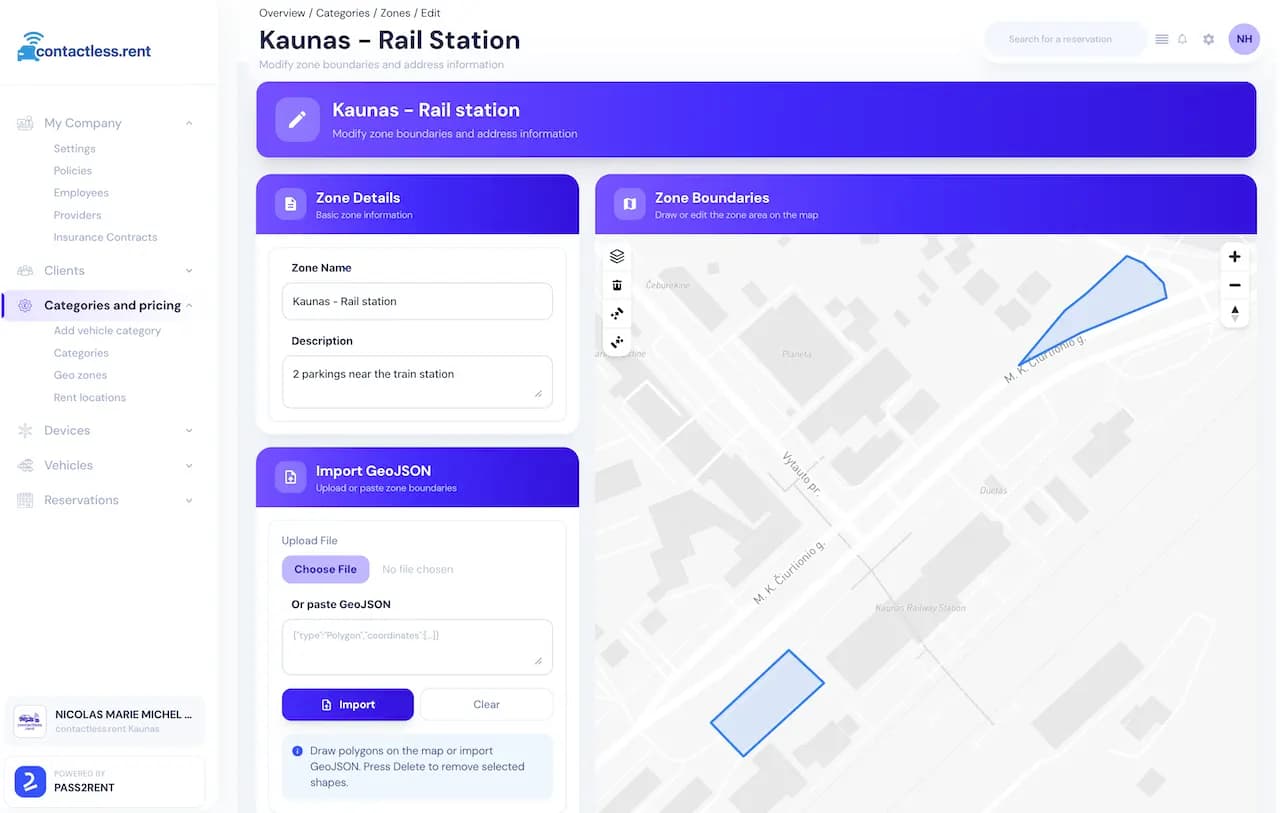
Draw
Zones
Draw zones directly on the map or import GeoJSON files to define where drivers can travel, and where vehicles can be picked up or returned.
- Draw polygons on interactive maps
- Import GeoJSON boundaries instantly
- Set driving restriction zones
- Define allowed operational areas